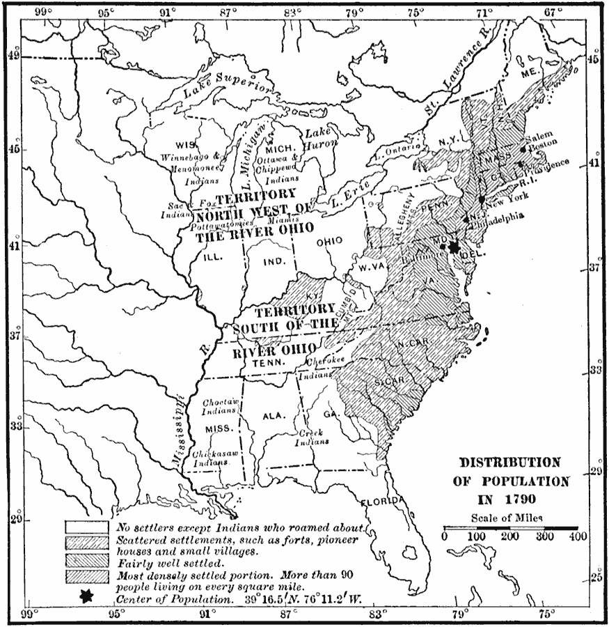
Description: A map of the original thirteen States in 1790 showing the distribution of the European–American population at the time and the general tribal lands of the Native Americans east of the Mississippi River. The map shows the State lines, rivers, and is keyed to show the non–settled areas, areas of scattered settlements such as such as forts, pioneer houses, and small villages, areas fairly well settled, and the most densely populated areas where population densities exceed 90 inhabitants per square mile. The map shows the mean center of population for the United States at the time located in Maryland, with the latitude and longitude coordinates given.
Place Names: Demographics, New York, �Philadelphia, �Boston, �populatio
ISO Topic Categories: boundaries,
inlandWaters,
location,
oceans
Keywords: American Population, physical, �political, �statistical, kPopulation, physical features, country borders,
major political subdivisions, population, boundaries,
inlandWaters,
location,
oceans, Unknown, 1790
Source: Ralph S. Tarr, B.S., F.G.S.A. and Frank M. McMurry, Ph.D., New Geographies 2nd ed (New York, NY: The Macmillan Company, 1910) 28
Map Credit: Courtesy the private collection of Roy Winkelman |
|