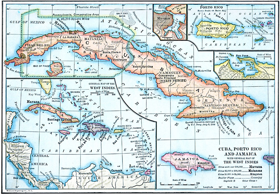
Description: A map from 1910 of Cuba, Jamaica, and Porto Rico (Puerto Rico), showing provinces, capitals and major cities, mountain systems, rivers, coastal features, and smaller banks and islands. Several inset maps are given, including a general map of the West Indies with the Greater Antilles, Lesser Antilles, and Bahamas, a map detailing Puerto Rico and Virgin Islands, a detail of Havana Harbor, and a detail of San Juan Bay. An outline of Pennsylvania at the same map scale overlays northern Cuba to show comparative area size.
Place Names: A Regional Map of North America, Cuba, �United States, �Puerto Rico, �West Indies, �Hait
ISO Topic Categories: boundaries,
location,
oceans,
inlandWaters
Keywords: Cuba, Puerto Rico, and Jamaica, physical, �political, kCaribbean, kComparativeArea, physical features, country borders, boundaries,
location,
oceans,
inlandWaters, Unknown, 1910
Source: Ralph S. Tarr, B.S., F.G.S.A. and Frank M. McMurry, Ph.D., New Geographies 2nd ed (New York, NY: The Macmillan Company, 1910) 152
Map Credit: Courtesy the private collection of Roy Winkelman |
|