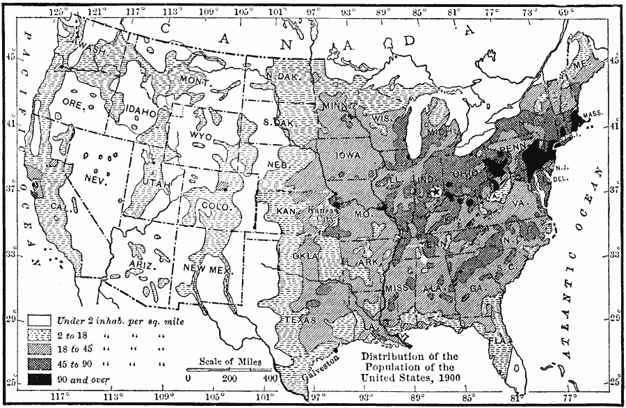
Description: A map from 1910 of the United States showing the distribution of the population in 1900. The map is keyed to show areas of population with densities ranging from under 2 inhabitants per square mile to 90 and over inhabitants per square mile. The mean center of population for the United States at the time was located in Indiana.
Place Names: Demographics, populatio
ISO Topic Categories: boundaries,
inlandWaters,
location,
oceans,
society
Keywords: Population in the United States, physical, �political, kPopulation, physical features, country borders,
major political subdivisions, boundaries,
inlandWaters,
location,
oceans,
society, Unknown, 1900
Source: Ralph S. Tarr, B.S., F.G.S.A. and Frank M. McMurry, Ph.D., New Geographies 2nd ed (New York, NY: The Macmillan Company, 1910) 181
Map Credit: Courtesy the private collection of Roy Winkelman |
|