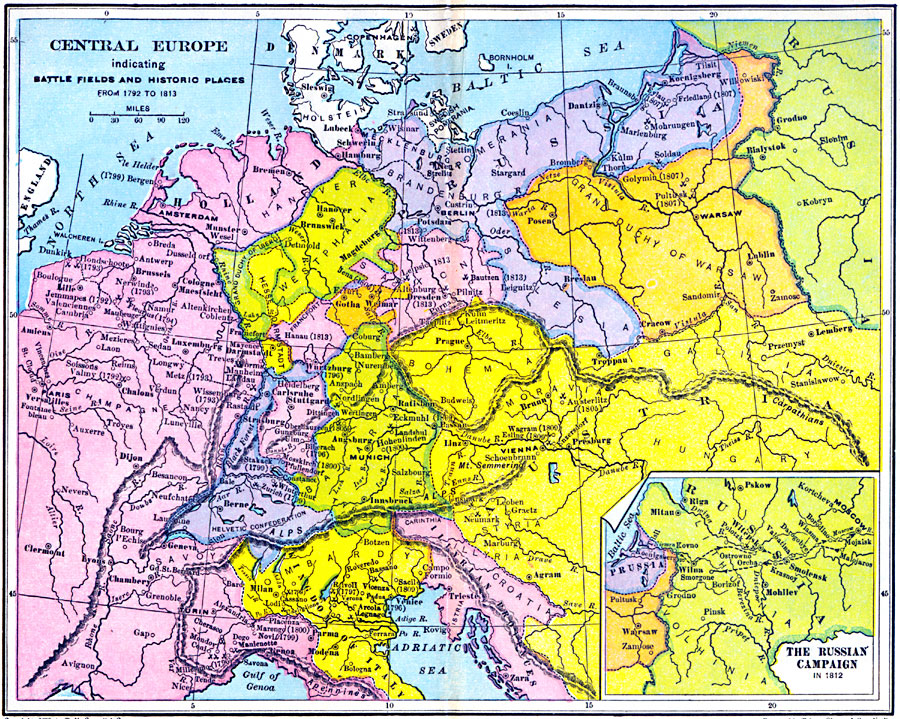
Description: A map of Central Europe between 1792 and 1813 indicating major battlefield sites and historic places with associated dates noted in parentheses. The countries shown include Denmark–Holstein, Swedish Pomerania, Holland, Prussia, Westphalia, Grand Duchy of Warsaw, Darmstadt, Saxony, Bohemia, Austria, Bavaria, Salzburg, Würtemburg, Helvetic Confederation, and portions of France, the Kingdom of Italy, the Illyrian Provinces, and Russia. The inset map shows Napoleon's French campaign into Russia.
Place Names: Western and Central Europe, Austria, �England, �France, �Germany, �Holland, �Italy, �Poland, �Russia, �Sweden, �United Kingdo
ISO Topic Categories: location
Keywords: Central Europe indicating Battle Fields and Historic Places, country borders, �historical, �military, �political, kNapoleonBonaparte, country borders, other military, location, Unknown, 1792–1813
Source: Victor Duruy, Edwin A. Grosvenor, & Louis E. Van Norman, Duruy's General History of the World (vol. II) (New York, NY: The Review of Reviews Company, 1912) 362-363
Map Credit: Courtesy the private collection of Roy Winkelman |
|