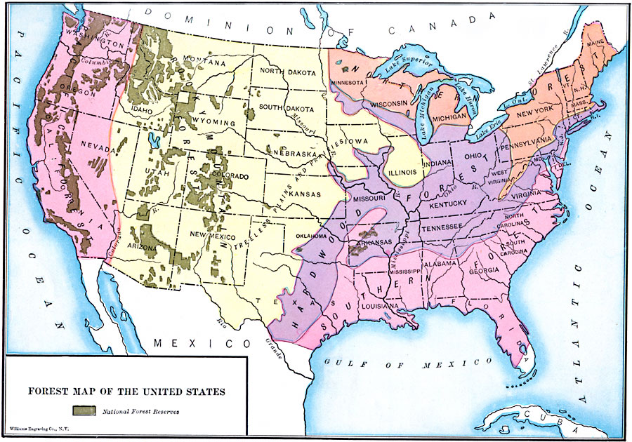
Description: A map from 1910 of the United States showing the forest regions of the Pacific, Rocky Mountains, Northern Forest in the Great Lakes and New England areas, Southern Forest along the Gulf and East Coast, and the Hardwood Forest. The map shows the National Forest Reserves, primarily in the Pacific and Rocky Mountain forests of the west.
Place Names: Forestry,
ISO Topic Categories: boundaries,
location,
oceans,
inlandWaters,
biota
Keywords: Forest Map of the United States, physical, �political, �statistical, physical features, country borders,
major political subdivisions, vegetation, boundaries,
location,
oceans,
inlandWaters,
biota, Unknown, 1910
Source: Ralph S. Tarr, B.S., F.G.S.A. and Frank M. McMurry, Ph.D., New Geographies 2nd ed (New York, NY: The Macmillan Company, 1910) 186
Map Credit: Courtesy the private collection of Roy Winkelman |
|