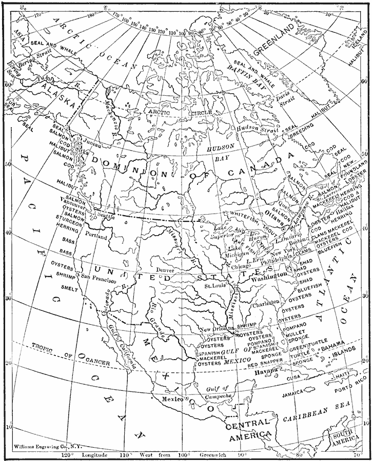
Description: A map from1910 of North America showing the distribution of primary commercial fish in the region, including oysters, clams, sponges, turtles, shrimp, lobster, whales and seals. The map shows marine species as well the freshwater salmon rivers and lake fish, turtle and sponge areas of the Atlantic and Caribbean, and the seal breeding grounds near the Hudson Strait.
Place Names: A Complete Map of North America, New York, �Canada, �Mexico, �Greenland, �Arctic Ocean, �Alaska, �Pacific Ocean, �Atlantic Ocean, �Hudson Bay, �Cuba, �Puerto Rico, �Porto Rico, �Gulf of Mexico, �United State
ISO Topic Categories: boundaries,
location,
oceans,
inlandWaters
Keywords: Distribution of Fish in North America, physical, �political, kFishery, physical features, major political subdivisions,
country borders, economic, boundaries,
location,
oceans,
inlandWaters, Unknown, 1910
Source: Ralph S. Tarr, B.S., F.G.S.A. and Frank M. McMurry, Ph.D., New Geographies 2nd ed (New York, NY: The Macmillan Company, 1910) 188
Map Credit: Courtesy the private collection of Roy Winkelman |
|