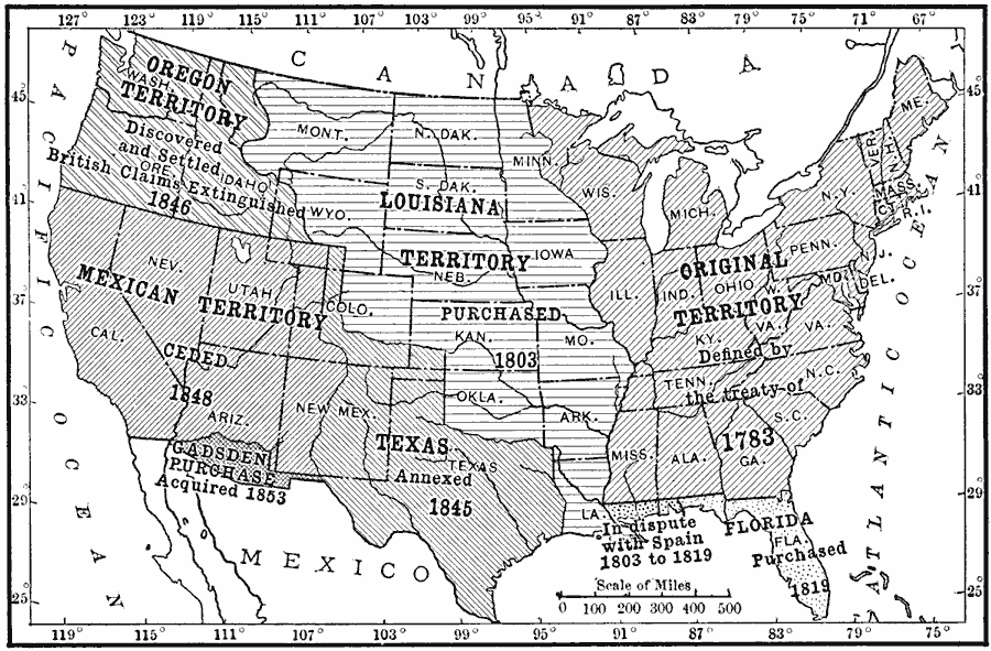
Description: A map from 1910 of the United States showing the territorial acquisitions from the original states and territory established in 1783 to the Gadsden Purchase in northern Mexico in 1853. This map shows the territories acquired under the Louisiana Purchase in 1803, the disputed territory of West Florida between 1803 and 1819, the purchase of the Florida territories from Spain in 1819, the Texas annexation in 1845, Oregon Country in 1846, the Mexican territories ceded in 1848, and the Gadsden Purchase in 1853.
Place Names: Growth of Nation, Oregon Country, �East Florida, �West Florida, �Mexican Cession, �Louisiana Purchase, �Texas, �Gadsden Purchas
ISO Topic Categories: boundaries,
location,
oceans,
inlandWaters
Keywords: U.S. Territorial Acquisitions, physical, �political, physical features, major political subdivisions,
country borders, boundaries,
location,
oceans,
inlandWaters, Unknown, 1783–1853
Source: Ralph S. Tarr, B.S., F.G.S.A. and Frank M. McMurry, Ph.D., New Geographies 2nd ed (New York, NY: The Macmillan Company, 1910) 197
Map Credit: Courtesy the private collection of Roy Winkelman |
|