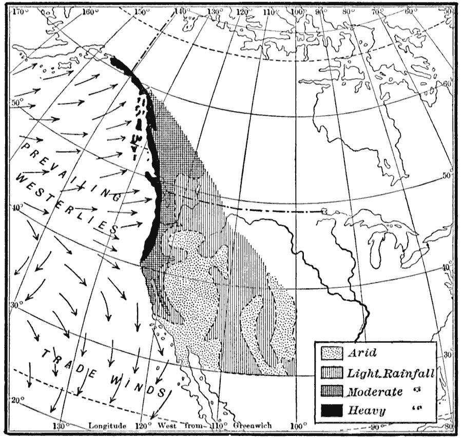
Description: A map from 1910 of the west coast of North America showing general mean annual rainfall patterns and the effect of the prevailing Westerlies and Trade Winds off the Pacific on rainfall. The map shows arid regions, and areas of light, moderate, and heavy rainfall, and prevailing wind directions.
Place Names: A Regional Map of North America, United States, �Canad
ISO Topic Categories: location,
inlandWaters,
oceans,
geoscientificInformation
Keywords: Rainfall on the West Coast, political, �physical, �meteorological, kClimate, physical features, country borders, rainfall, location,
inlandWaters,
oceans,
geoscientificInformation, Unknown, 1910
Source: Ralph S. Tarr, B.S., F.G.S.A. and Frank M. McMurry, Ph.D., New Geographies 2nd ed (New York, NY: The Macmillan Company, 1910) 211
Map Credit: Courtesy the private collection of Roy Winkelman |
|