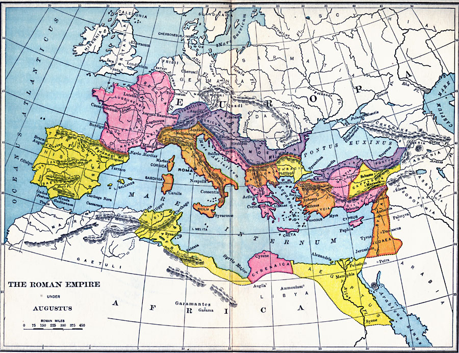
Description: A map of the extent of the Roman Empire under Augustus (63 BC to AD 14). The map is color–coded to show the territories, and uses Latin place names such as Mare Internum (Mediterranean Sea), Pontus Euxinus (Black Sea), and Danubius Fl. (Danube River). Important cities of the time are shown, as well as major rivers and terrain.
Place Names: Italy, Africa, �Asia, �Belgica, �Belgium, �Hispania, �Judea, �Lycia, �Macedonia, �Rome, �Sicily, �Spain, �Syri
ISO Topic Categories: location
Keywords: The Roman Empire Under Augustus, historical, �local jurisdictions,�political, kRomanEmpire, local jurisdictions, location, Unknown, 27 BC to AD 14
Source: Victor Duruy, Edwin A. Grosvenor, & Louis E. Van Norman, Duruy's General History of the World (vol. I) (New York, New York: The Review of Reviews Company, 1912)
Map Credit: Courtesy the private collection of Roy Winkelman |
|