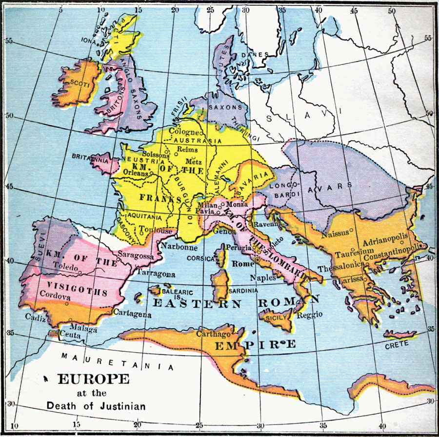
Description: A Map of Europe at the time of the death of Byzantine Emperor Justinian in ad 565. The map shows the Eastern Roman Empire, Kingdom of the Visigoths, Kingdom of the Franks, Kingdom of the Lombards, and territories held by the Anglo–Saxons, Avars, Scoti, Suevi, and other groups. The map also shows major rivers and important cities of the time.
Place Names: A Complete Map of Europe, Avars, �Carthage, �Franks, �Lombards, �Rome, �Sicily, �Visigoths,
ISO Topic Categories: location
Keywords: Europe at the Death of Justinian, country borders, �historical, �kingdoms, �political, kByzantineEmpire, country borders, location, Unknown, AD 565
Source: Victor Duruy, Edwin A. Grosvenor, & Louis E. Van Norman, Duruy's General History of the World (vol. I) (New York, New York: The Review of Reviews Company, 1912)
Map Credit: Courtesy the private collection of Roy Winkelman |
|