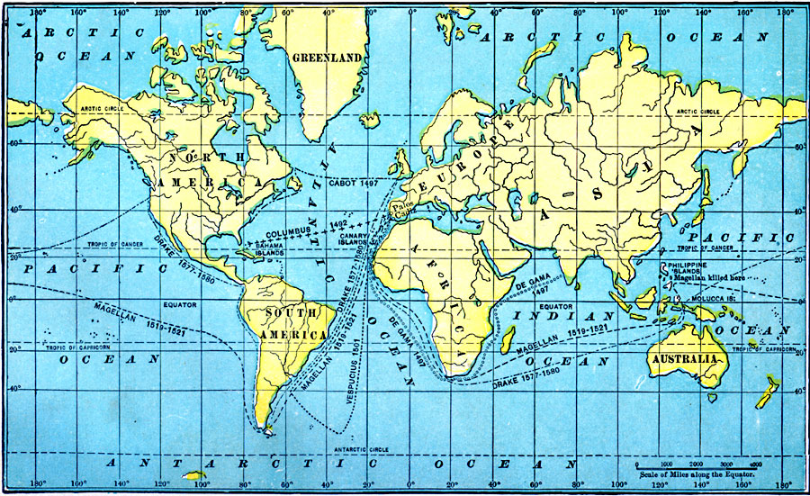
Description: A world map from 1911 showing the voyages of European exploration between 1492 and 1580. The map shows the routes of Columbus (1492), De Gama (1497), Cabot (1497), Vespucius (1501), Magellan (1519–1522, including the site in the Philippines where Magellan was killed), and Drake 1577–1580).
Place Names: A Complete Map of Globes and Multi-continent, Africa, �Antarctica, �Asia, �Australia, �Europe, �North America, �South Americ
ISO Topic Categories: location,
oceans,
inlandWaters,
boundaries
Keywords: Great Voyages, historical, �local jurisdictions, �political, �transportation, �water routes, water routes, historical event, location,
oceans,
inlandWaters,
boundaries, Unknown, 1492–1580
Source: John Clark Ridpath , History of the United States from Aboriginal Times to Taft's Administration (vol. 1) (New York, New York: The Review of Reviews Company, 1911)
Map Credit: Courtesy the private collection of Roy Winkelman |
|