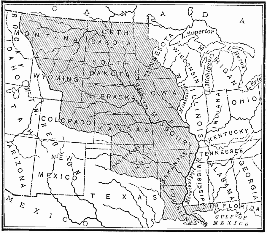
Description: A map of the Louisiana territory purchased from France in 1803, and the boundary established with the western Spanish territory by the purchase. The map overlays the current State boundaries to show the extent of the territory.
Place Names: Growth of Nation, Arkansas, �Colorado, �Iowa, �Kansas, �Louisiana, �Minnesota, �Mississippi River, �Missouri, �Montana, �Nebraska, �North Dakota, �Oklahoma, �South Dakota, �Wyoming, �Louisiana Purchas
ISO Topic Categories: oceans,
location,
inlandWaters
Keywords: The Louisiana Purchase, historical, local jurisdictions, water routes, historical event, oceans,
location,
inlandWaters, Unknown, 1803
Source: William Swinton, First Lessons in Our Countries History (New York, NY: American Book Company, 1894) 143
Map Credit: Courtesy the private collection of Roy Winkelman |
|