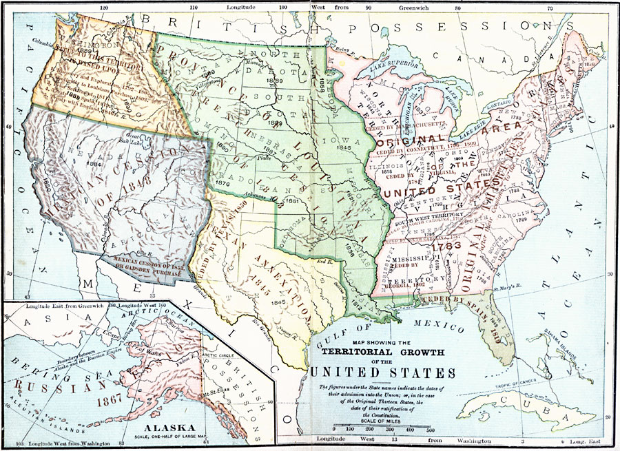
Description: A map from 1894 of the United States showing the territorial growth from the original States and the Northwest Territory in 1783 to the Russian cession of Alaska in 1867. The map is color–coded to show the progression from the original thirteen States and Northwest Territory, the French cession of Louisiana in 1803, the Oregon Country by discovery and exploration in 1803, Spanish cession of Florida in 1819, Texas annexation in 1845 and cession in 1850, the first Mexican cession in 1848, second Mexican cession or Gadsden Purchase in 1853, and includes an inset map showing the Russian purchase in 1867.
Place Names: Growth of Nation, Louisiana, �Mississippi, �North Territory, �Texa
ISO Topic Categories: oceans,
location,
inlandWaters
Keywords: The Territorial Growth of the United States , historical, local jurisdictions, water routes, historical event, oceans,
location,
inlandWaters, Unknown, 1783–1853
Source: William Swinton, First Lessons in Our Countries History (New York, NY: American Book Company, 1894)
Map Credit: Courtesy the private collection of Roy Winkelman |
|