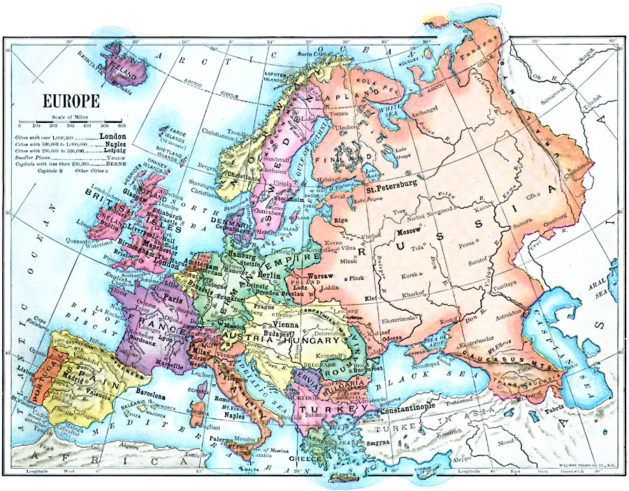
Description: A map of the political boundaries in Europe as they existed in 1910, including the German Empire and Austria–Hungary.
Place Names: A Complete Map of Europe, France, �Germany, �Greece, �Spain, �Portugal, �Italy, �Austria-Hungary, �Serbia, �Bulgaria, �Romania, �Sweden, �United Kingdo
ISO Topic Categories: boundaries,
location,
oceans,
inlandWaters
Keywords: Europe, physical, �political, physical features, country borders, boundaries,
location,
oceans,
inlandWaters, Unknown, 1910
Source: Ralph S. Tarr, B.S., F.G.S.A. and Frank M. McMurry, Ph.D., New Geographies 2nd ed (New York, NY: The Macmillan Company, 1910) 256
Map Credit: Courtesy the private collection of Roy Winkelman |
|