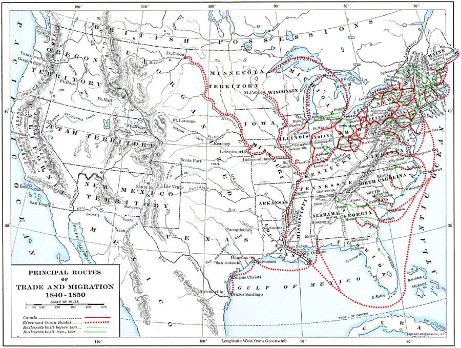
Description: A map of the United States showing the principal trade and westward migration routes between 1840 and 1850. The map shows state and territory boundaries at the time, major cities, ports, outposts, forts, and settlements, rivers, mountain barriers, and is keyed to show the canals, river and ocean routes, railroads built before 1840, and railroads built between 1840 and 1850. The map shows the principal westward migration routes from Independence and Leavenworth to the Pacific, including the Oregon Trail, Northern California Trail, Santa Fe Trail, Emory's Route, and Cooke's Wagon Route, and the Old Spanish San Antonio Road from the Rio Grande east.
Place Names: Growth of Nation, Mobile, �New York, �San Diego, �Los Angeles, �Boston, �Chicago, �New Orleans, �Houston, �Washington D.C., �Texas, �New Mexic
ISO Topic Categories: boundaries,
location,
inlandWaters,
oceans,
transportation
Keywords: Trade and Migration, physical, �political, �transportation, physical features, country borders,
major political subdivisions, railroads,
water routes, boundaries,
location,
inlandWaters,
oceans,
transportation, Unknown, 1840–1850
Source: Albert Bushnell Hart, LL.D., The American Nation (New York, NY: Harper and Brothers, 1906) 18
Map Credit: Courtesy the private collection of Roy Winkelman |
|