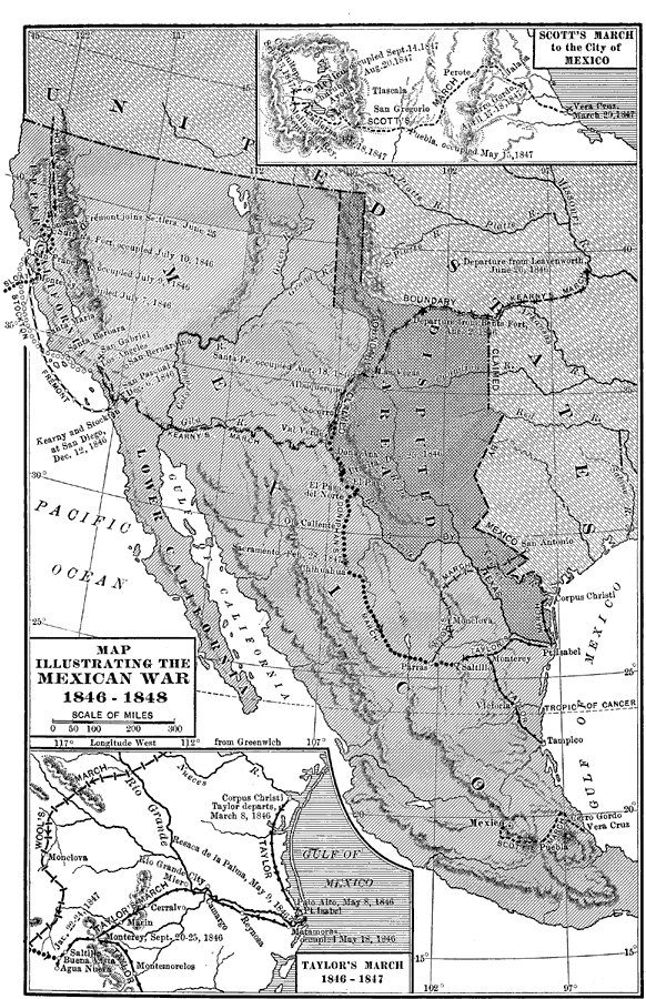
Description: A map of Mexico and southern United States showing the campaigns and battle sites of the Mexican–American War (1846–1848). The map shows the routes of Taylor, Wool, Kearny, Doniphan, and Scott, the pre–war boundaries of the United States and Mexico, and the disputed territory claimed by Mexico and Texas. Inset maps detail Scott's march to the City of Mexico (1847–1848), and Taylor's march in northern Mexico (1846–1847).
Place Names: A Regional Map of North America, Mexico, �United State
ISO Topic Categories: boundaries,
location,
inlandWaters,
oceans,
intelligenceMilitary
Keywords: The Mexican War, physical, �political, �transportation, physical features, country borders,
major political subdivisions, railroads, boundaries,
location,
inlandWaters,
oceans,
intelligenceMilitary, Unknown, 1846–1848
Source: Albert Bushnell Hart, LL.D., The American Nation (New York, NY: Harper and Brothers, 1906) 244
Map Credit: Courtesy the private collection of Roy Winkelman |
|