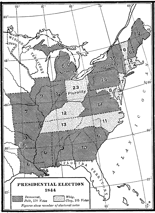
Description: A map of the United States showing the results of the 1844 presidential election. The map is keyed to show the states carried by the Democrats (James Knox Polk) and Whigs (Henry Clay). The figures indicate the number of Electoral Votes for each State.
Place Names: Elections, Presidential Electio
ISO Topic Categories: boundaries,
inlandWaters,
location,
oceans
Keywords: Presidential Election, physical, �political, physical features, country borders,
major political subdivisions, boundaries,
inlandWaters,
location,
oceans, Unknown, 1844
Source: Albert Bushnell Hart, LL.D., The American Nation (New York, NY: Harper and Brothers, 1906) 282
Map Credit: Courtesy the private collection of Roy Winkelman |
|