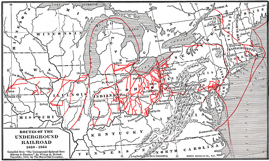
Description: The routes of the Underground Railroad, 1830-1865.
Place Names: Eastern States, Boston, �Philadelphia, �Chicago, �Cincinnati, �railroad
ISO Topic Categories: boundaries,
inlandWaters,
location,
oceans,
transportation
Keywords: Routes of the Underground Railroad, physical, �political, �transportation, physical features, country borders,
major political subdivisions, roads,
water routes, boundaries,
inlandWaters,
location,
oceans,
transportation, Unknown, 1830–1865
Source: Albert Bushnell Hart, LL.D., The American Nation Vol.16 (New York, NY: Harper and Brothers, 1906) 230
Map Credit: Courtesy the private collection of Roy Winkelman |
|