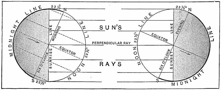
Description: A diagram from 1901 showing the Earth's angle of inclination on the summer and winter solstices. The inclination of the earth on the summer solstice (about June 21) is shown on the left, and on the winter solstice (about December 21) on the right. The diagram shows the perpendicular ray of the sun on these dates reaching the Tropic of Cancer on the summer solstice, and Tropic of Capricorn on the winter solstice. The Arctic and Antarctic circles are shown touching the solstice sunrise line and sunset line, indicating that depending on the solstice, the sun never rises or never sets pole–ward of the circles.
Place Names: Solar System, Eart
ISO Topic Categories:
Keywords: Inclination of Earth on Solstices, Midnight Line, �Six O'clock Morning, �Sunrise Line, �Equator, Unknown, 1901
Source: Jacques W. Redway, Natural Advanced Geography (New York, New York: American Book Company, 1901) 23
Map Credit: Courtesy the private collection of Roy Winkelman |
|