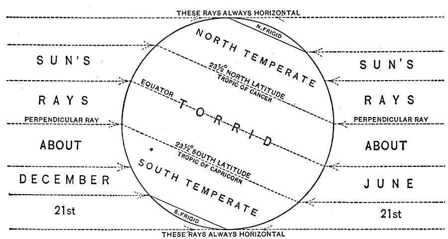
Description: A chart from 1901 showing the effect of the sun's rays on the torrid and frigid temperature zones during the annual solstices. "The sun's rays are always perpendicular somewhere between the tropics, and that part of the earth's surface is quite warm throughout the year; hence the strip between the tropics is called the torrid, or hot zone. Because the sun's rays do not reach the regions within the polar circles during part of the year, and during the remainder are nearly horizontal, these regions are nearly always cold and are called the frigid, or cold, zones. The regions between the torrid and frigid zones are called temperate zones." — Redway, 1901, p.24.
Place Names: Solar System, Eart
ISO Topic Categories: climatologyMeteorologyAtmosphere
Keywords: Sun's Rays and Temperature Zones during the Solstices, meteorological, kClimate, climate,
temperature, climatologyMeteorologyAtmosphere, Unknown, 1901
Source: Jacques W. Redway, Natural Advanced Geography (New York, New York: American Book Company, 1901) 24
Map Credit: Courtesy the private collection of Roy Winkelman |
|