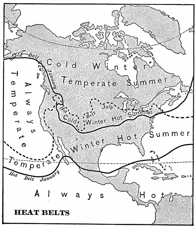
Description: A base map from 1901 of North America, Central America, Greenland, and the Caribbean to Puerto Rico showing the heat belts of the region. The map shows the isotherm boundaries of the cold belt in January with a mean temperature of 30° Fahrenheit, the hot belt in January (solid line) and July (dashed line) with the isotherm of mean temperature of 70° Fahrenheit. The map shows areas of cold winters and temperate summers, coastal areas of constant temperate temperatures in the Pacific Northwest, the area of temperate winter and hot summer, and the area where it is always hot.
Place Names: A Complete Map of North America, Bahamas, �Canada, �Cuba, �Mexico, �United State
ISO Topic Categories: climatologyMeteorologyAtmosphere,
inlandWaters,
oceans
Keywords: North American Heat Belts, physical, �meteorological, kClimate, physical features, climate,
temperature, climatologyMeteorologyAtmosphere,
inlandWaters,
oceans, Unknown, 1901
Source: Jacques W. Redway, Natural Advanced Geography (New York, NY: American Book Company, 1901) 46
Map Credit: Courtesy the private collection of Roy Winkelman |
|