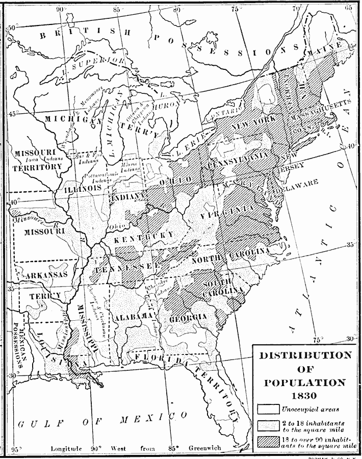
Description: A population map of United States and territories in 1830 showing the distribution of the European–American population at the time and the general tribal lands of the Native Americans east of the Mississippi River. The map shows the State lines, rivers, and is keyed to show unoccupied areas (European–American), areas of population densities of 2 to 18 inhabitants per square mile, and areas of population densities of 18 to over 90 inhabitants per square mile.
Place Names: Demographics, populatio
ISO Topic Categories: boundaries,
oceans,
inlandWaters,
location
Keywords: Distribution of Population, physical, �political, kPopulation, physical features, country borders,
major political subdivisions, boundaries,
oceans,
inlandWaters,
location, Unknown, 1830
Source: Albert Bushnell Hart, LL.D., The American Nation Vol 14 (New York, NY: Harper and Brothers, 1906) 70
Map Credit: Courtesy the private collection of Roy Winkelman |
|