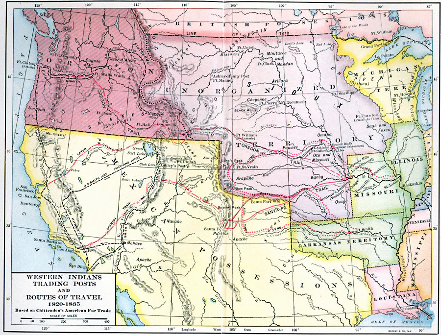
Description: The trading posts, routes of travel, and the distribution of Native American tribes in the American West, 1820—1835.
Place Names: Western States, New Orleans, �San Diego, �Los Angeles, �Chicago, �California, �Great Plains, �Pacific States, �Rocky Mountain Region, �Texas, �Washington State, �West Coas
ISO Topic Categories: boundaries,
inlandWaters,
location,
oceans,
transportation
Keywords: The West, physical, �political, �statistical, �transportation, kNativeAmerican, physical features, country borders,
major political subdivisions, ethnological, roads, boundaries,
inlandWaters,
location,
oceans,
transportation, Unknown, 1820–1835
Source: Albert Bushnell Hart, LL.D., The American Nation Vol 14 (New York, NY: Harper and Brothers, 1906) 114
Map Credit: Courtesy the private collection of Roy Winkelman |
|