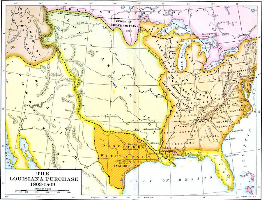
Description: A map of the United States and the Louisiana Territory showing boundary disputes and boundary claims between 1763 and 1809. The map shows the natural boundaries and extent of the original Louisiana Territory claimed by the French, the portion ceded to Britain in 1763, the portion ceded to the United States in 1782, the portion purchased by the United States in 1803, and the portion ceded to Great Britain along the Canadian border in 1818. This map also shows the British territory along the Canadian border ceded to the United States in 1818, the Oregon Country claimed by the United States, the Spanish possessions in the west, the territory disputed with Spain in Texas and West Florida, and the territory of East Florida.
Place Names: Growth of Nation, New York, �New Orleans, �Louisiana Purchas
ISO Topic Categories: boundaries,
inlandWaters,
location,
oceans
Keywords: The Louisiana Purchase, physical, �political, physical features, country borders,
major political subdivisions, boundaries,
inlandWaters,
location,
oceans, Unknown, 1803–1809
Source: Albert Bushnell Hart, LL.D., The American Nation Vol 12 (New York, NY: Harper and Brothers, 1906) 70
Map Credit: Courtesy the private collection of Roy Winkelman |
|