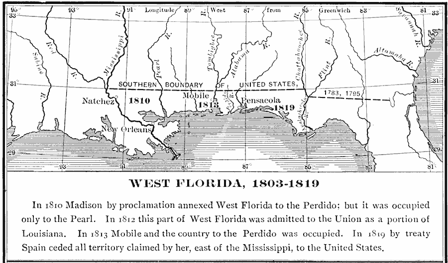
Description: A map of the disputed territory of West Florida showing the United States claim after the Louisiana Purchase (1803) and President Madison's annexation (1810) from the Mississippi River to the Pearl River, the occupation to the Perdido River in 1813, and the cession of all the Florida Territory by Spain in 1819.
Place Names: Growth of Nation, Pensacola, �Mobile, �New Orleans, �West Florida, �Louisiana Purchas
ISO Topic Categories: boundaries,
inlandWaters,
location,
oceans
Keywords: West Florida, physical, �political, physical features, country borders,
major political subdivisions, boundaries,
inlandWaters,
location,
oceans, Unknown, 1803–1819
Source: Albert Bushnell Hart, LL.D., The American Nation Vol 12 (New York, NY: Harper and Brothers, 1906) 142
Map Credit: Courtesy the private collection of Roy Winkelman |
|