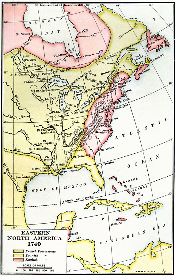
Description: A map of eastern North America, Gulf of Mexico, and western Caribbean showing the European possessions and territorial claims in the region in 1740. The map is color–coded to show the French, Spanish, and British possessions at the time. The map shows cities, forts, and settlements at the beginning of the King George's War (1740–1748).
Place Names: A Regional Map of North America, Canada, �Mexico, �United State
ISO Topic Categories: boundaries,
inlandWaters,
location,
oceans
Keywords: Early Possessions in Eastern North America, physical, �political, physical features, major political subdivisions, boundaries,
inlandWaters,
location,
oceans, Unknown, 1740
Source: Albert Bushnell Hart, LL.D., The American Nation Vol 7 (New York, NY: Harper and Brothers, 1906) 106
Map Credit: Courtesy the private collection of Roy Winkelman |
|