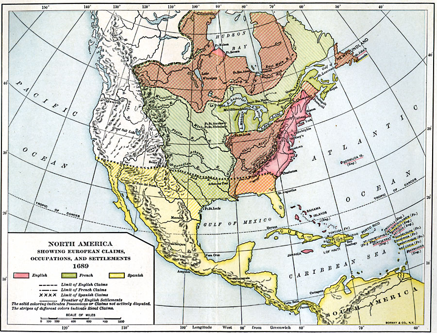
Description: A map of North America, Central America, and the West Indies in 1689 at the beginning of the King William's War (1689–1697), the first of the French and Indian Wars. The map is color–coded to show the claims of the English, French, and Spanish, with solid colors indicating non–disputed territories, and striped colors representing rival claims. The limits of the English, French and Spanish claims are given by representative lines, and the frontier of English settlements along the East Coast is shown by a line that corresponds to the ‘Fall Line,’ the natural barrier of foothills to river travel.
Place Names: A Regional Map of North America, Canada, �Bahamas, �Cuba, �United States, �Mexic
ISO Topic Categories: boundaries,
inlandWaters,
location,
oceans
Keywords: North America, physical, �political, kCaribbean, physical features, local jurisdictions, boundaries,
inlandWaters,
location,
oceans, Unknown, 1689
Source: Albert Bushnell Hart, LL.D., The American Nation Vol 6 (New York, NY: Harper and Brothers, 1906) 6
Map Credit: Courtesy the private collection of Roy Winkelman |
|