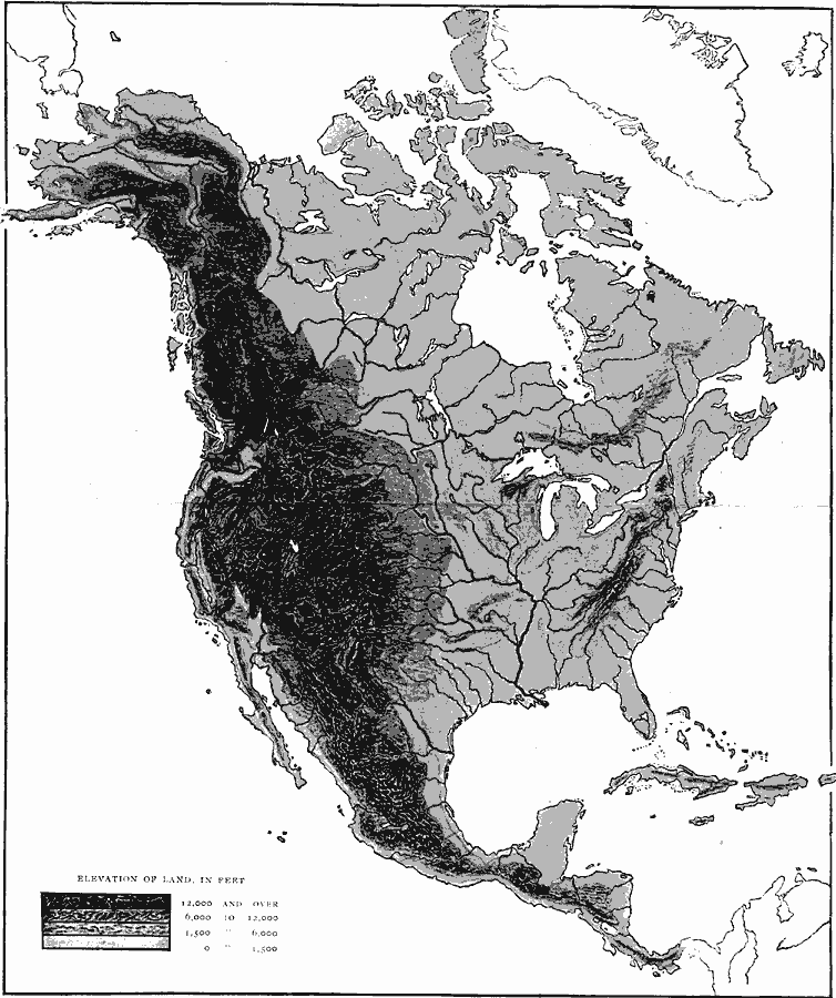
Description: A relief map from 1906 of North America, Central America, Greenland, and the Caribbean to Puerto Rico showing the general highlands and plains of the region. The map is keyed to show land area elevations from sea level to above 12,000 feet. Major river systems are shown.
Place Names: A Complete Map of North America, Bahamas, �Canada, �Cuba, �United States, �Mexic
ISO Topic Categories: elevation,
location,
oceans,
inlandWaters
Keywords: Relief of North America, physical, kRelief, physical features, elevation,
location,
oceans,
inlandWaters, Unknown, 1906
Source: Albert Bushnell Hart, LL.D., The American Nation Vol 2 (New York, NY: Harper and Brothers, 1906) 4
Map Credit: Courtesy the private collection of Roy Winkelman |
|