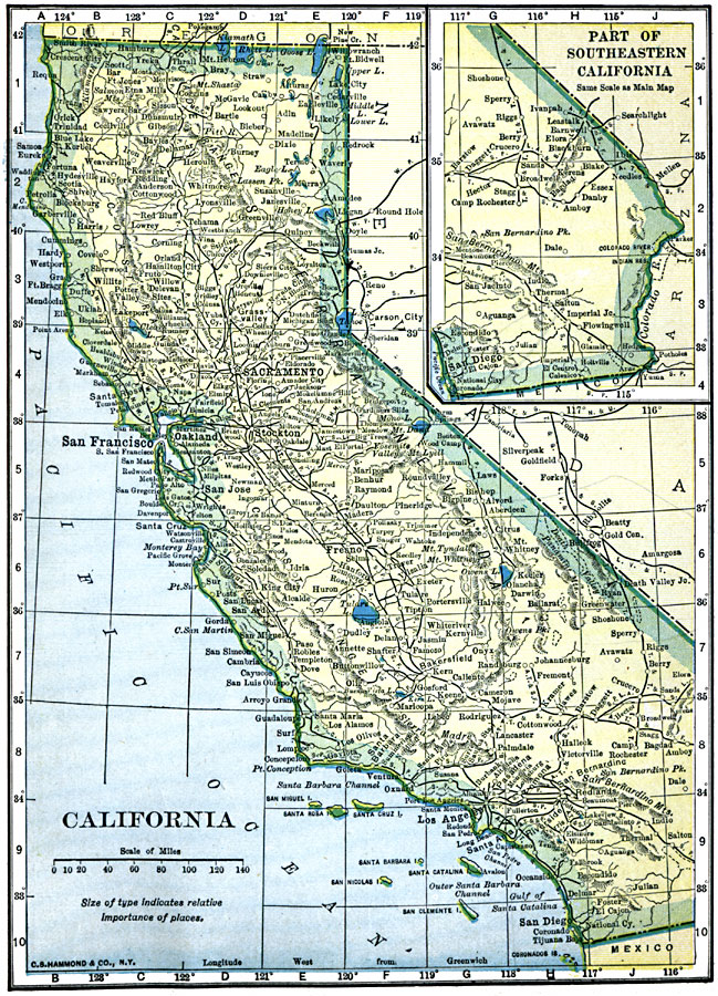
Description: A map of California from 1909 showing the State capital of Sacramento, major cities and towns, railroads, mountain systems, lakes, rivers, and coastal features. An inset map shows the continuation of the southeast part of the state.
Place Names: California, Beverly Hills, �Fresno, �Los Angeles, �Oakland, �Sacramento, �San Diego, �San Francisco,
ISO Topic Categories: oceans,
location,
inlandWaters
Keywords: California, historical, �Indian reservations, �local jurisdictions, �political, local jurisdictions, oceans,
location,
inlandWaters, Unknown, 1909
Source: C. S. Hammond, Hammond's Handy Atlas of the World (New York, NY: C. S. Hammond & Company, 1911) 62
Map Credit: Courtesy the private collection of Roy Winkelman |
|