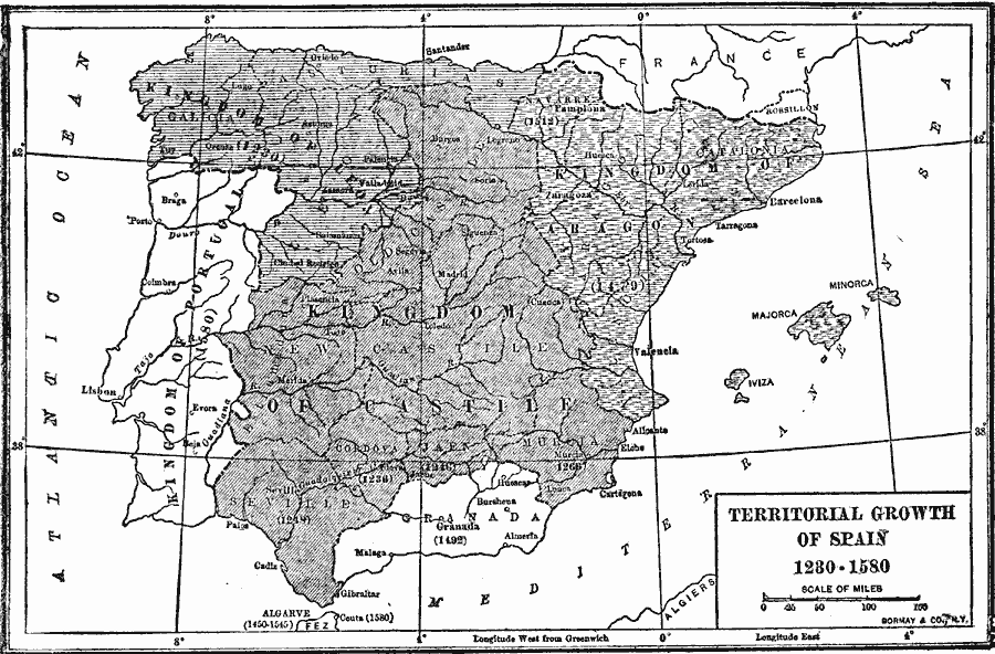
Description: A map showing the territorial growth of Spain from the inheritance of the Kingdom of Leon to Ferdinand III of Castile (1230) to the conquest of Portugal in1580 under the Iberian Union. The map shows territorial acquisitions and dates for the territories of Cordova (1236), Jaen (1246), Seville (1248), Murcia (1266), Kingdom of Aragon (1479), Granada (1492), and Navarre (1512). The map also shows the territories in North Africa of Algarve (1450–1545) and the city of Ceuta (1580).
Place Names: Spain, Barcelona, �Madrid, �Cadiz, �Cordoba, �Tarragon
ISO Topic Categories: boundaries,
inlandWaters,
location,
oceans
Keywords: Territorial Growth of Spain, physical, �political, physical features, country borders,
major political subdivisions, boundaries,
inlandWaters,
location,
oceans, Unknown, 1230–1580
Source: Albert Bushnell Hart, LL.D., The American Nation Vol 1 (New York, NY: Harper and Brothers, 1906) 81
Map Credit: Courtesy the private collection of Roy Winkelman |
|