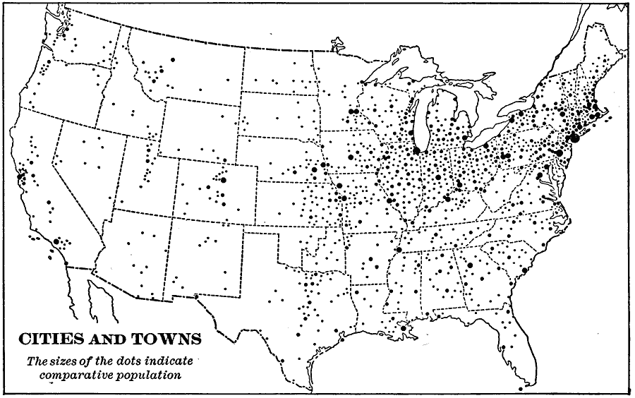
Description: A map from 1901 of the contiguous 48 states showing the distribution pattern of the major cities and towns at the time. The larger dots represent the major manufacturing centers and greater population.
Place Names: A Complete Map of the United States,
ISO Topic Categories: boundaries,
inlandWaters,
oceans
Keywords: United States Cities and Towns, physical, �political, physical features, major political subdivisions,
country borders, boundaries,
inlandWaters,
oceans, Unknown, 1901
Source: Jacques W. Redway, Natural Advanced Geography (New York, NY: American Book Company, 1901) 59
Map Credit: Courtesy the private collection of Roy Winkelman |
|