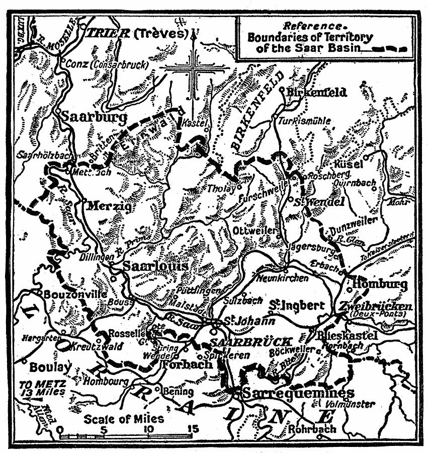
Description: A map showing the Sarr Basin of western Germany in 1914, formerly an important coal–mining and industrialized area. This map shows major cities, including Saarbrück, Saarlouis, Merzig, and Saarburg, railways, rivers, and terrain of the region.
Place Names: Germany,
ISO Topic Categories: boundaries,
inlandWaters,
location
Keywords: The Saar Basin, political, �physical, physical features, local jurisdictions, boundaries,
inlandWaters,
location, Unknown, 1919
Source: Charles Morris, Winston's Cumulative Encyclopedia Vol 9 (Philadelphia, PA: The John C. Winston Company, 1919) tab 15
Map Credit: Courtesy the private collection of Roy Winkelman |
|