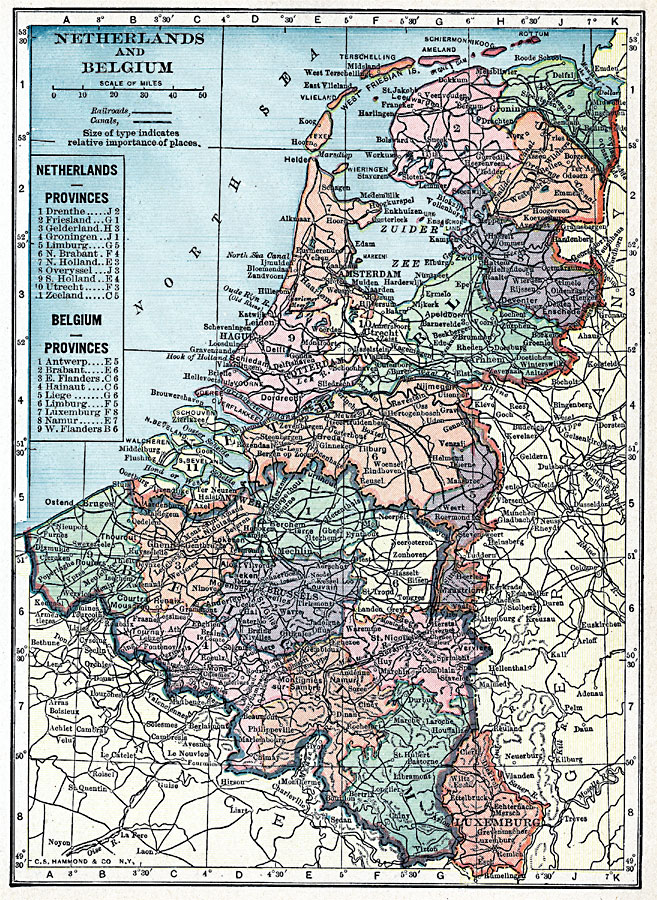
Description: A map from 1919 of the Netherlands and Belgium, showing major cities and towns, railroads and canals, and the provinces of each country numbered and referenced on the map legend.
Place Names: Low Countries, Netherlands�Belgiu
ISO Topic Categories: boundaries,
location,
oceans,
inlandWaters
Keywords: Belgium and the Netherlands, physical, �transportation, �political, physical features, country borders,
major political subdivisions, railroads,
water routes, boundaries,
location,
oceans,
inlandWaters, Unknown, 1919
Source: Charles Morris, Winston's Cumulative Encyclopedia Vol 7 (Philadelphia, PA: The John C. Winston Company, 1919) tab 7
Map Credit: Courtesy the private collection of Roy Winkelman |
|