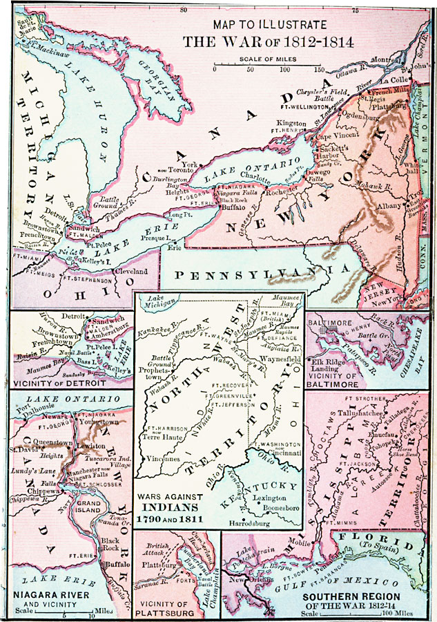
Description: A series of maps showing the important sites of the War of 1812–1814 between the United States and England, with insets detailing the northern region of the Great Lakes east to Lake Champlain, the vicinity of Detroit, the vicinity of Baltimore, the Niagara River and vicinity, the vicinity of Plattsburg, and the southern region of the war. The inset in the center of the map details the North West Territories and the war against the Indians between 1790 and 1811.
Place Names: A Regional Map of North America, Baltimore, �Detroit, �Mexico, �Niagara River, �Plattsburg, �United State
ISO Topic Categories: oceans,
location,
inlandWaters
Keywords: The War of 1812, 1812, �colonies, �historical, �military,other military,
historical event, oceans,
location,
inlandWaters, Unknown, 1812–1815
Source: A. S. Barnes, A Brief History of the United States (New York, NY: American Book Company, 1885)
Map Credit: Courtesy the private collection of Roy Winkelman |
|