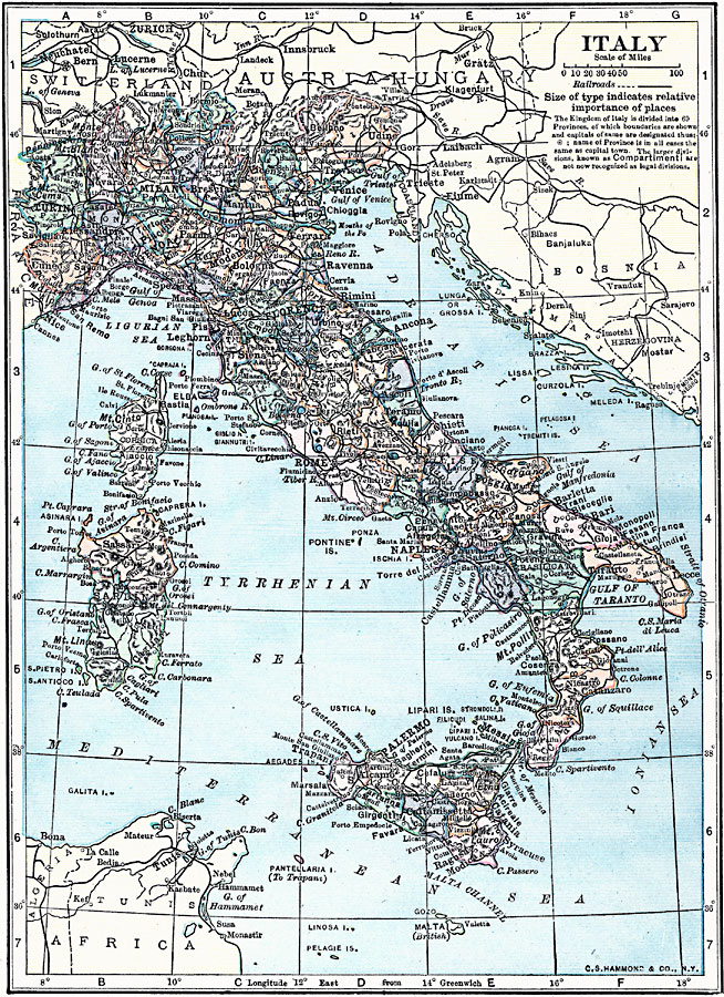
Description: A map of Italy in 1919, however, it shows the Italian provinces prior to the resolution of the Italian Irredentist Movement to unite the territories of ethnic Italians under the London Pact of 1915. This map shows the territories of Tyrol, Istria, and Dalmatia under Austria–Hungary Empire rule, Corsica under French, and Malta under British control. This map shows major cities, railways, rivers, terrain, and the provinces of the Kingdom of Italy at the time.
Place Names: Italy, Bologna, �Florence, �Genoa, �Messina, �Milan, �Naples, �Pisa, �Rome, �Venic
ISO Topic Categories: boundaries,
transportation,
inlandWaters,
location,
oceans
Keywords: Italy, physical, �political, �transportation, physical features, country borders,
major political subdivisions, railroads, boundaries,
transportation,
inlandWaters,
location,
oceans, Unknown, 1919
Source: Charles Morris, Winston's Cumulative Encyclopedia Vol 5 (Philadelphia, PA: The John C. Winston Company, 1919) tab 8
Map Credit: Courtesy the private collection of Roy Winkelman |
|