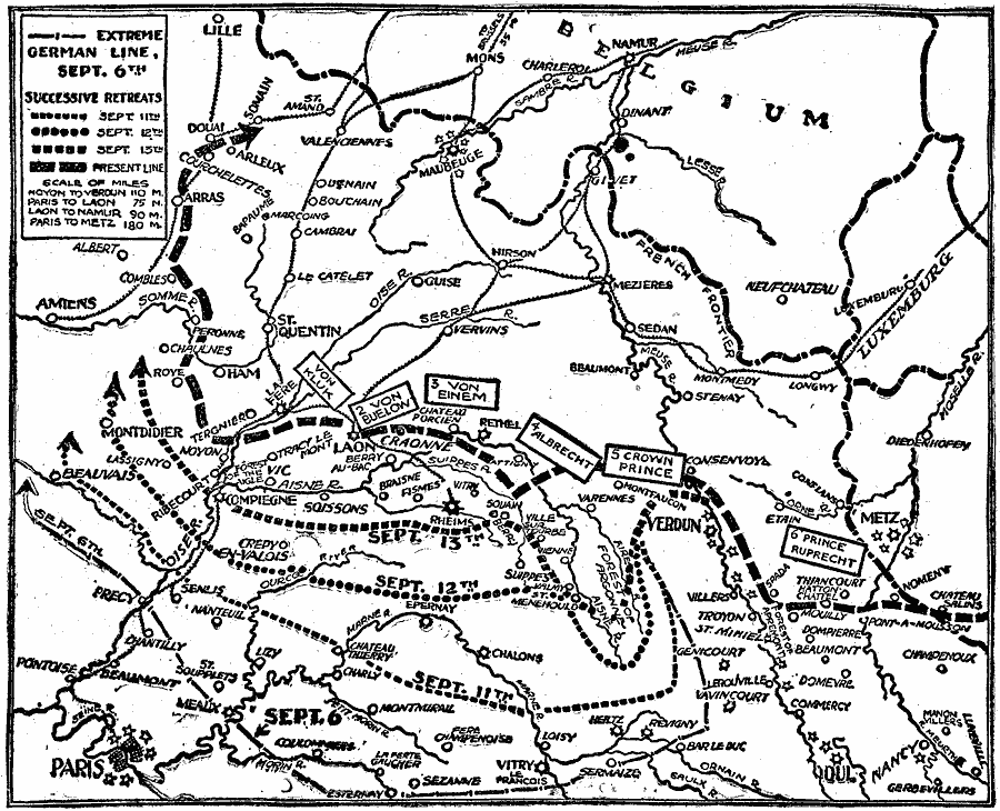
Description: A map showing the successive German retreats during the allied "Hundred Days" offensive in the Western Front, from their extreme extent in France on September 6 to their positions on September 18, 1918. The map shows major cities, railways, fortified points, and battle sites of the region, and the positions of German troops under Von Kluk, Von Buelow, Von Einem, Albrecht, Crown Prince, and Prince Ruprecht on September 18. The map also shows distances between strategic points, including Noyon to Verdun (110 miles), Paris to Laon (75 miles), Laon to Namur (90 miles), and Paris to Metz (180 miles).
Place Names: Western Europe, France, �Belgium, �Luxemburg, Paris, Amiens, Lille, Verdun, Forest of Argonne, Rheims, Metz
ISO Topic Categories: inlandWaters,
location,
transportation
Keywords: German Retreat from Paris, physical, �historical, �transportation, �political, kWWI, physical features, local jurisdictions, railroads, WWI, inlandWaters,
location,
transportation, Unknown, September 6–18, 1918
Source: Charles Morris, Winston's Cumulative Encyclopedia Vol 4 (Philadelphia, PA: The John C. Winston Company, 1919) tab 2
Map Credit: Courtesy the private collection of Roy Winkelman |
|