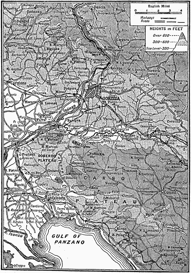
Description: A map of northeastern Italy from the Gulf of Panzano (Adriatic Sea) to Gorizia on the River Isonzo during the Italian national Irredentist Movement to unify ethnic Italians of the Austrian Empire after the Treaty of Saint–Germain–en–Laye (1919). The map shows cities, roads, railways, rivers, and terrain of the Doberdo and Carso plateaus.
Place Names: Italy, Gorizi
ISO Topic Categories: transportation,
intelligenceMilitary,
inlandWaters,
location,
oceans,
boundaries,
elevation
Keywords: Italian Irredenta, physical, �political, �transportation, physical features, major political subdivisions, roads,
railroads, transportation,
intelligenceMilitary,
inlandWaters,
location,
oceans,
boundaries,
elevation, Unknown, 1919
Source: Charles Morris, Winston's Cumulative Encyclopedia Vol 4 (Philadelphia, PA: The John C. Winston Company, 1919) tab 3
Map Credit: Courtesy the private collection of Roy Winkelman |
|