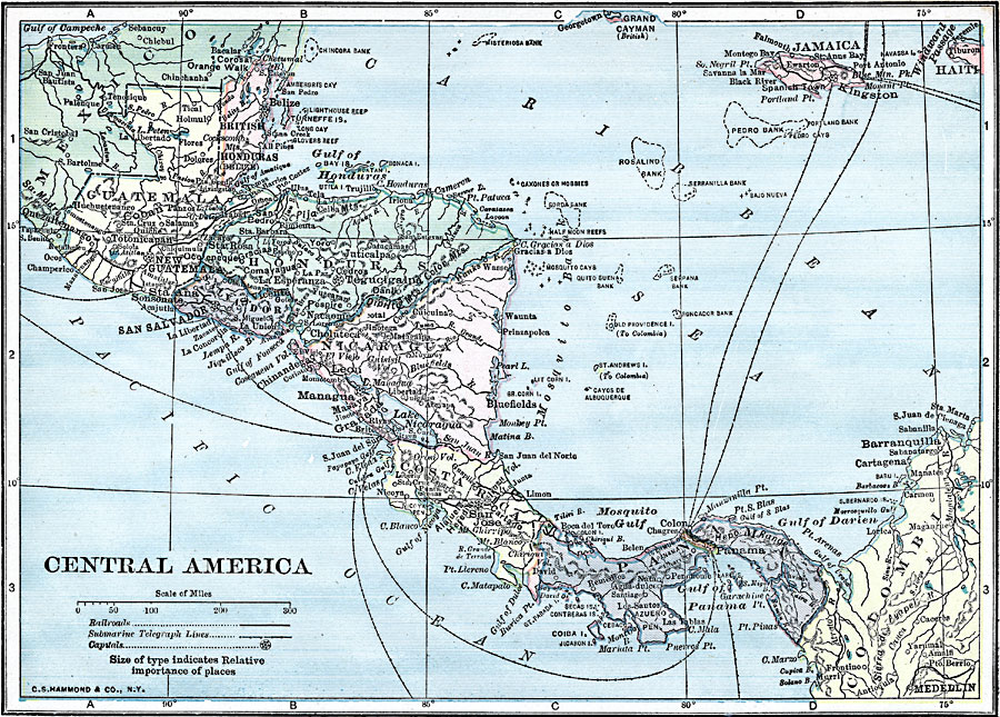
Description: A map from 1919 of Central America showing political boundaries at the time, capitals and major cities, railroads, submarine telegraph cables, mountain systems, lakes, rivers, coastal features, banks or reefs, and the islands of Jamaica and Grand Cayman. The map includes the countries of British Honduras (Belize), Guatemala, Salvador, Honduras, Nicaragua, Costa Rica, and Panama with the Canal Zone.
Place Names: A Regional Map of North America, Mexico, �Panama, �Costa Rica, �Nicaragua, �Honduras, �Guatemal
ISO Topic Categories: utilitiesCommunication,
boundaries,
inlandWaters,
location,
oceans,
transportation
Keywords: Central America, physical, �political, �transportation, kCentralAmerica, physical features, country borders, water routes, utilitiesCommunication,
boundaries,
inlandWaters,
location,
oceans,
transportation, Unknown, 1919
Source: Charles Morris, Winston's Cumulative Encyclopedia Vol 2 (Philadelphia, PA: The John C. Winston Company, 1919) tab 11
Map Credit: Courtesy the private collection of Roy Winkelman |
|