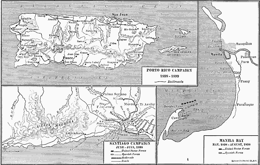
Description: A map showing three regions of conflict during the Spanish–American War (1898), including the Puerto Rico Campaign (1898–1899), Santiago de Cuba (June–July, 1898), and Manila Bay in the Philippines (May–August, 1898). The maps show major cities, railways, roads, and positions of U.S and Spanish forces for each area.
Place Names: Regional Americas, North America, �Asi
ISO Topic Categories: physical, �political, �historical, �spanish-american war, �transportation, kWorldAmericas, kWorldPacific
Keywords: Campaigns of the Spanish-American War, physical, �political, �historical, �spanish-american war, �transportation, physical features, local jurisdictions, railroads, other military, physical, �political, �historical, �spanish-american war, �transportation, kWorldAmericas, kWorldPacific, Unknown, 1919
Source: Albert Bushnell Hart, L.L.D., The American Nation Vol. 25 (New York, NY: Harper and Brothers, 1907) 46
Map Credit: Courtesy the private collection of Roy Winkelman |
|