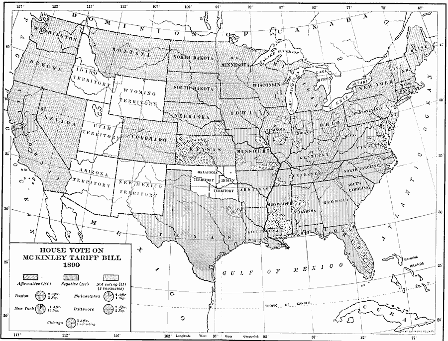
Description: A map of the United States showing the results of the House vote on the McKinley Tariff Bill, 1890. The proposed tariff was on imported manufactured goods, and while protecting the manufacturing industry, placed hardships on the agricultural industry, becoming a hotly debated bill. The map shows the voting results and reflects the manufacturing sector in the north and agricultural sector in the south. The voting break–outs for the cities of Boston, Philadelphia, New York, Baltimore, and Chicago are shown.
Place Names: Elections, House Vot
ISO Topic Categories: boundaries,
oceans,
location,
inlandWaters
Keywords: House Vote on the McKinley Tariff, physical, �political, physical features, boundaries,
oceans,
location,
inlandWaters, Unknown, 1890
Source: Albert Bushnell Hart, LL.D., The American Nation Vol. 24 (New York, NY: Harper and Brothers, 1907) 172
Map Credit: Courtesy the private collection of Roy Winkelman |
|