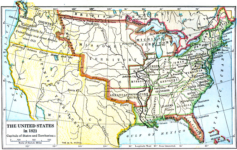
Description: A map of the United States and territories showing the westward expansion after the Missouri Compromise (1820) and the admission of Missouri into the Union in 1821. The map is color–coded to show the state boundaries (green), the territories claimed by the United States, including the Missouri Territory, Michigan Territory, Arkansas Territory, and East Florida (brown), the boundary of the British claims, including the disputed border in Maine (red), and the Spanish possessions as established by the Treaty of 1819 (Adams–Onís). The map shows the line of the United States frontier in 1820 by a heavy black line, and notes the Oregon Country being jointly occupied by Great Britain and United States since 1818.
Place Names: Growth of Nation, Arkansas Territory, �Connecticut, �Delaware, �Florida, �Georgia, �Kentucky, �Louisiana, �Maine, �Massachusetts, �Missouri Territory, �New Hampshire, �New Jersey, �New York, �North Carolina, �Oregon Country, �Pennsylvania, �Rhode Island, �South Caro
ISO Topic Categories: oceans,
location,
inlandWaters,
boundaries
Keywords: The United States, borders, �historical, �physical, �physical features, historical event, oceans,
location,
inlandWaters,
boundaries, Unknown, 1821
Source: S.E. Forman, Advanced American History (New York, NY: The Century Company, 1919)
Map Credit: Courtesy the private collection of Roy Winkelman |
|