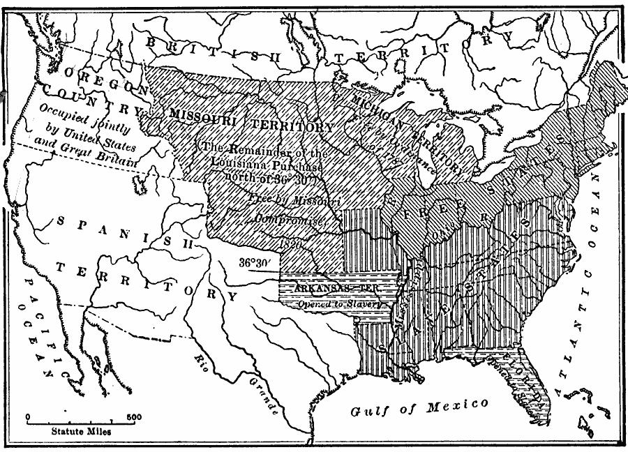
Description: A map of the United States in 1821 showing the results of the Missouri Compromise of 1820 over the issue of prohibition of slavery. The map is coded to show the areas of the Free States, the Slave States, the Michigan Territory as Free by the Ordinance of 1787, the portion of the Missouri Territory that allowed slavery, the remainder of the Louisiana Purchase (Missouri Territory) north of 36° 30' Free by the Missouri Compromise, the Arkansas Territory open to slavery, and Florida open to slavery.
Place Names: Growth of Nation, Arkansas Territory, �Florida, �free states, �Missouri Territory, �Oregon Country, �slave states, �Spanish Territory, �United States,
ISO Topic Categories: oceans,
location,
inlandWaters,
boundaries
Keywords: The Result of the Missouri Compromise, borders, �historical, �physical, ��physical features, historical event, oceans,
location,
inlandWaters,
boundaries, Unknown, 1821
Source: S.E. Forman, Advanced American History (New York, NY: The Century Company, 1919) 299
Map Credit: Courtesy the private collection of Roy Winkelman |
|