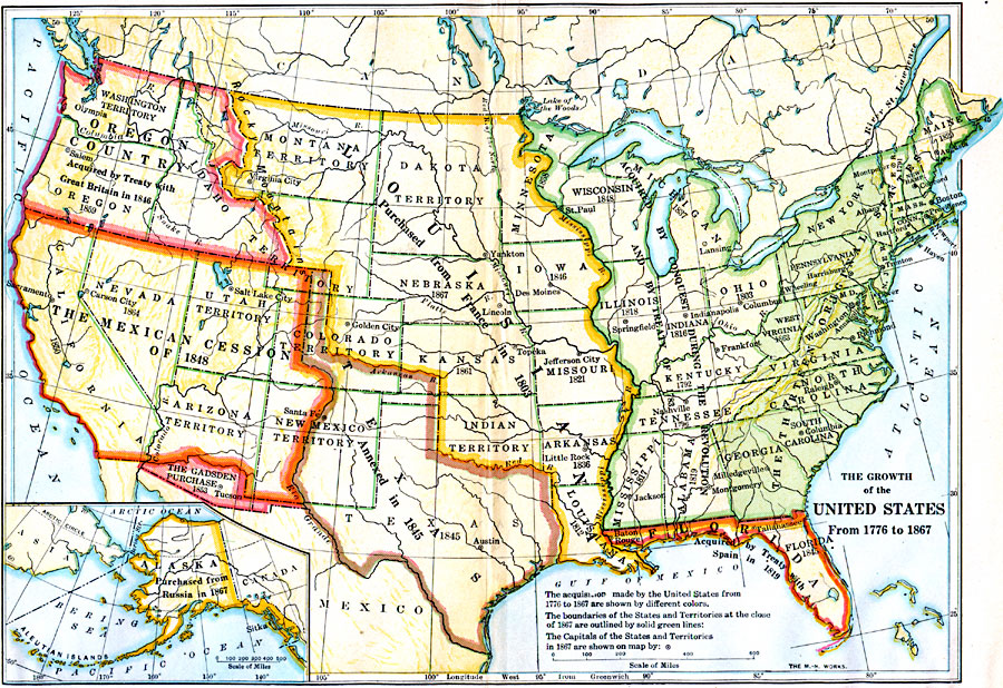
Description: A map of the United States showing the growth of the nation from 1776–1867. The map is color–coded to show the thirteen original states, the territory acquired by conquest during the revolution and the Treaty of 1783, the Louisiana Territory purchased from France in 1803, the Texas Territory annexed in 1845, the Oregon Country acquired by the treaty with Great Britain in 1846, the Mexican cession of western territories in 1848, the Gadsden Purchase in northern Mexico in 1853, and the purchase of Alaska from Russia in 1867. The map shows the boundaries and capitals of the states and territories at the close of 1867. An inset map details the territory of Alaska.
Place Names: Growth of Nation, Alaska, �Arkansas, �California, �Colorado territory, �Connecticut, �Dakota territory, �Delaware, �Florida, �Georgia, �Indian Territory, �Iowa, �Kentucky, �Louisiana, �Maine, �Massachusetts, �Michigan, �Minnesota, �Missouri, �Nevada, �New Hampshire,
ISO Topic Categories: oceans,
location,
inlandWaters,
boundaries
Keywords: The Growth of the United States, borders, �historical, �physical, �physical features, ethnological, historical event, oceans,
location,
inlandWaters,
boundaries, Unknown, 1776–1867
Source: S.E. Forman, Advanced American History (New York, NY: The Century Company, 1919)
Map Credit: Courtesy the private collection of Roy Winkelman |
|