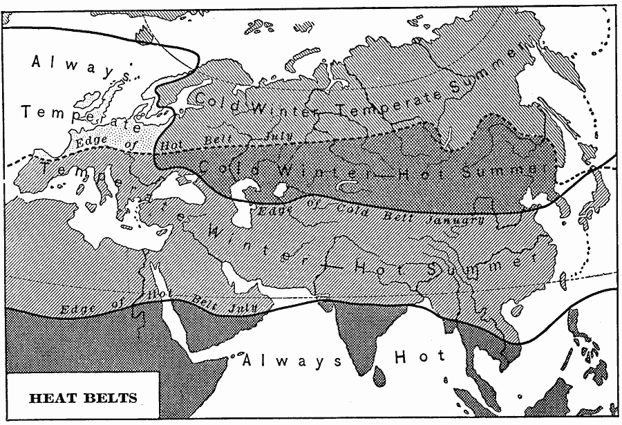
Description: A map from 1901 showing the heat belts in Eurasia. The map uses isotherm lines to show regions where the climate is always temperate, regions of cold winters and temperate summers, cold winters and hot summers, temperate winters and hot summers, and regions where the climate is always hot. This map shows the southern and northern edges of the hot belt in July and the edge of the cold belt in January.
Place Names: Regional EurAsia,
ISO Topic Categories: physical, �meteorological, kClimate, kWorldEurasia
Keywords: Eurasian Heat Belts, physical, �meteorological, kClimate, physical features, temperature,
climate, physical, �meteorological, kClimate, kWorldEurasia, Unknown, 1901
Source: Jacques W. Redway, Natural Advanced Geography (New York, New York: American Book Company, 1901) 114
Map Credit: Courtesy the private collection of Roy Winkelman |
|