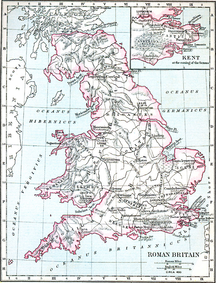
Description: A map of Britain near the end of the period of Roman control, circa AD 400. Place names and terrain features are given with their Roman names with modern names in parentheses. The map shows Roman settlements, roads, legion outposts, and the defensive structures of the Wall of Hadrian and the Wall of Antoninus. Two map scales are given, one in Roman miles and one in English miles. An inset map details the area of Kent at the time of the coming of the Saxons, covering the area from Ebbs Fleet on the coast to Londinium (London) on the River Thames.
Place Names: United Kingdom, London, �Manchester, �Mancunium, Viniconium, Isca Silurum, Sabrina Aest, Isca, Aquae Suhs, Portus Dulbrae, Canmlodunum, Londinium, Ratae, Lindum, Eboracum, Ituna Aest, Boderia Aestuaria, Hibernia, Caledoni
ISO Topic Categories: boundaries,
inlandWaters,
location,
oceans
Keywords: Roman Britain, physical, �political, �britain in the time of roman occupation circa 400, kRomanEmpire, physical features,
topographical, country borders,
major political subdivisions, boundaries,
inlandWaters,
location,
oceans, Unknown, Circa AD 400
Source: Samuel Rawson Gardiner D.C.L., L.L.D., School Atlas of English History (London, England: Longmans, Green, and Co., 1914) 1
Map Credit: Courtesy the private collection of Roy Winkelman |
|