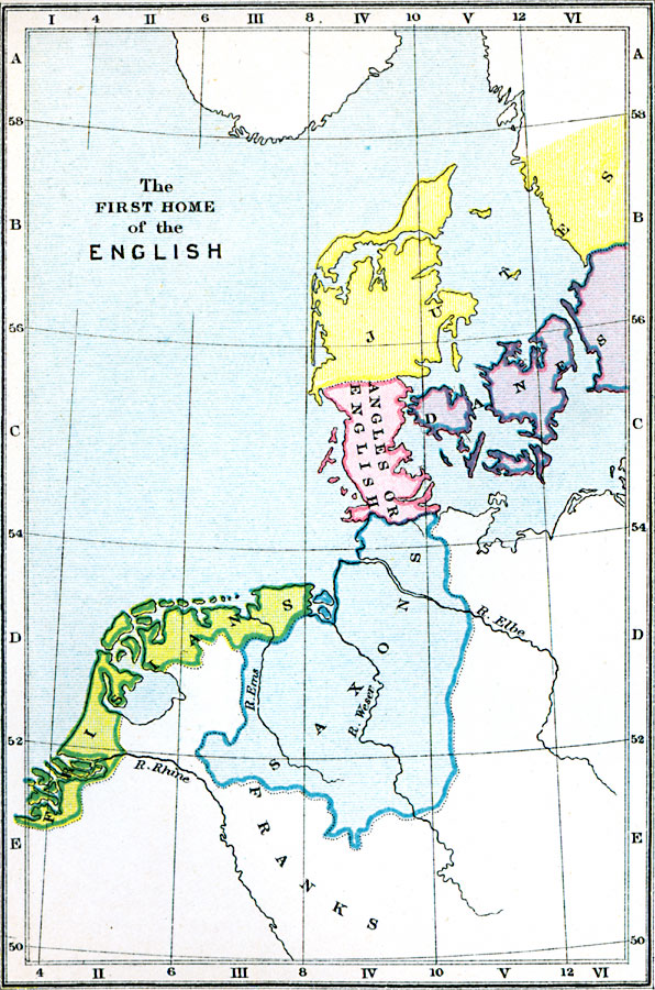
Description: A map of the ancestral home of the ethnic groups that would become the English.
Place Names: Western and Central Europe, Rhine River, Weser River, Elbe River, Erns Rive
ISO Topic Categories: inlandWaters,
oceans,
society
Keywords: The First Home of the English, physical, �statistical, �previous home of ethnic groups of england, danges, angles or english, saxons, isians, jutes, physical features,
topographical, ethnological, inlandWaters,
oceans,
society, Unknown, AD 400–600
Source: Samuel Rawson Gardiner D.C.L., L.L.D., School Atlas of English History (London, England: Longmans, Green, and Co., 1914) 2
Map Credit: Courtesy the private collection of Roy Winkelman |
|