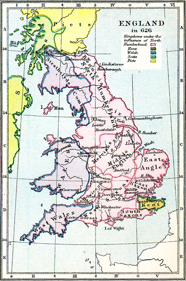
Description: A map of England and Wales in AD 626 at the beginning of the campaign against West Saxons by the Northumbrian King Eadwine (Edwin). The map is color–coded to show the kingdoms under the influence of North Humberland, the territory of Kent, and the territories of the Welsh to the west and the Scots and Picts to the north. The map shows the major settlements, rivers, and coastal features.
Place Names: United Kingdom, Kent, �Isle of Wight, �Wales, �London, �Bamborough, �Dorchester, �Winchester, �Bath, �Canterbury, �Gloucester, �Winchester, �Elmham, �Lincoln, �Leicester, �Godmundingham, �Yor
ISO Topic Categories: inlandWaters,
oceans,
society,
boundaries,
location
Keywords: England, physical, �statistical, �political, �england, middle english, east angles, south saxons, welsh, scots, picts, kingdoms under influence of humberland, physical features, country borders, ethnological, inlandWaters,
oceans,
society,
boundaries,
location, Unknown, AD 626
Source: Samuel Rawson Gardiner D.C.L., L.L.D., School Atlas of English History (London, England: Longmans, Green, and Co., 1914) 5
Map Credit: Courtesy the private collection of Roy Winkelman |
|