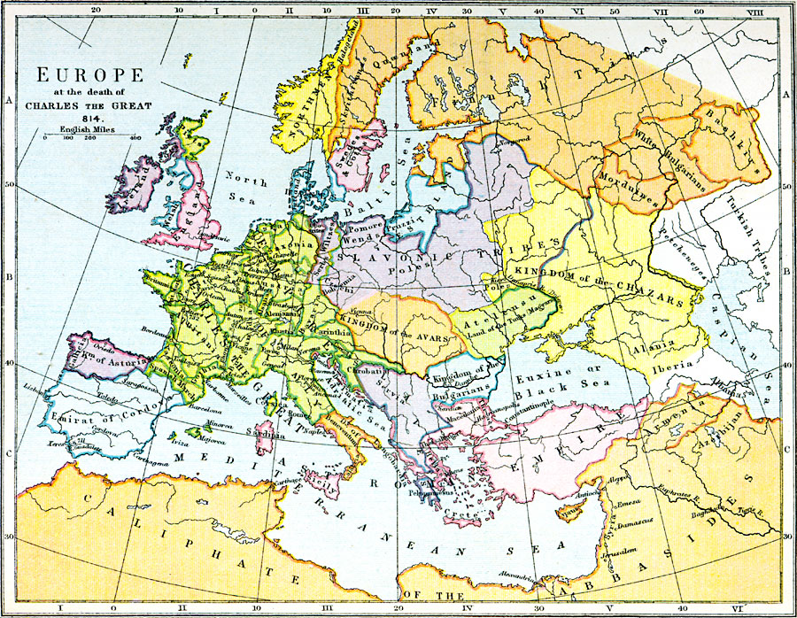
Description: A map showing the kingdoms, empires and domains of tribal groups in Europe at the death of Charles the Great in 814 CE.
Place Names: A Complete Map of Europe, England, Ireland, Emirat of Cordovia, Caliphate of the Abbasides, Gallicia, Kingdom of Asturia, Kingdom of the Avars, Kingdom of the Chazars, Caspian Sea, Quaenland, Italy, Sicily, Sardinia, East Roman Empire, Empire of Charles the Grea
ISO Topic Categories: inlandWaters,
oceans,
society,
boundaries,
location
Keywords: Europe at the Death of Charles the Great, physical, �statistical, �political, �historical, �europe at the death of charles the great in 814 ce, turkish, morduines, chaars, slavonic, poles, avars, magyars, swedes and goths, northmen, finnish, bulgarians, bashkirs, physical features, country borders,
major political subdivisions, ethnological, historical event, inlandWaters,
oceans,
society,
boundaries,
location, Unknown, AD 814
Source: Samuel Rawson Gardiner D.C.L., L.L.D., School Atlas of English History (London, England: Longmans, Green, and Co., 1914) 6
Map Credit: Courtesy the private collection of Roy Winkelman |
|