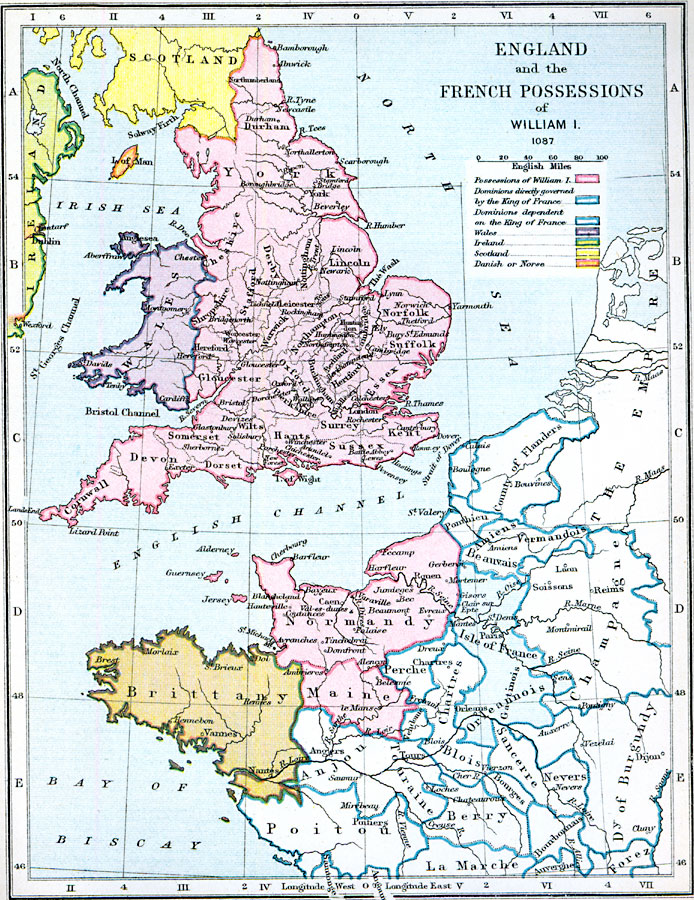
Description: A map of England and Northwestern France showing the possessions of King William I in 1087. The map is color–coded to show the possessions directly under the control of William I, dominions directly governed by the King of France, dominions dependent on the King of France, Wales, Ireland, Scotland, and the territories held by the Danish or Norse (Isle of Man and coastal Ireland at Wexford and Dublin).
Place Names: Western Europe, Wales, �Scotland, �Brittany, �Maine, �Normandy, �Poitou, �Bay of Biscay, �English Channel, �North Sea, �Irish Sea, �Ireland, �London, �Bamborough, �County of Flanders, �Norfolk, �Northampton, �Orelannois, �Champagn
ISO Topic Categories: boundaries,
inlandWaters,
location,
oceans
Keywords: England and the French Possessions of William I, physical, �political, �possessions of william I, william 1, william one, dominions directly governed by the king of france, wales, ireland, scotland, danish or norse, dominions dependent on the king of france, physical features, country borders,
major political subdivisions, boundaries,
inlandWaters,
location,
oceans, Unknown, AD 1087
Source: Samuel Rawson Gardiner D.C.L., L.L.D., School Atlas of English History (London, England: Longmans, Green, and Co., 1914) 10
Map Credit: Courtesy the private collection of Roy Winkelman |
|