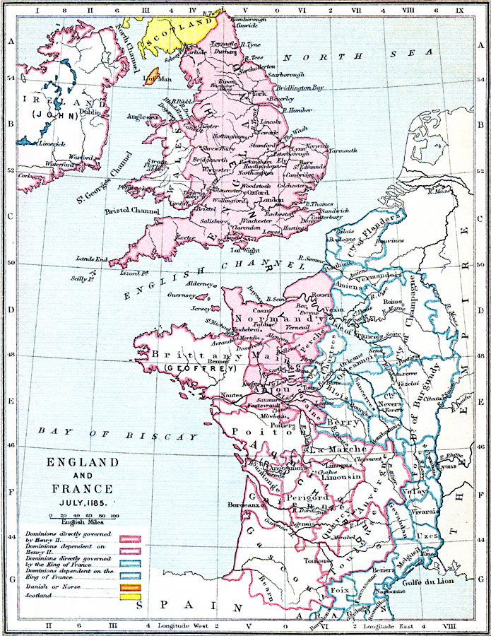
Description: A map of England and France in July, 1185. The map is color–coded to show the dominions governed by and dependent on Henry II and the King of France. It also shows the land belonging to Scotland and the Danish or Norse (Isle of Man).
Place Names: Western Europe, England, �London, �Wales, �Scotland, �Ireland, �Dublin, �Oxford, �Woodstock, �Yarmouthh, �York, �Bamborough, �Normandy, �Bay of Biscay, �English Channel, �Maine, �Brittany, �Anjou, �La Marche, �Gascony, �Spain, �County of Flanders, �Franc
ISO Topic Categories: boundaries,
inlandWaters,
location,
oceans
Keywords: England and France, physical, �political, �dominions directly governed by henry II, dominions dependent on henry ii, dominions directly governed by the king of france, dominions dependent on the king of france, danish or norse, scotland, physical features, country borders,
major political subdivisions, boundaries,
inlandWaters,
location,
oceans, Unknown, 1185
Source: Samuel Rawson Gardiner D.C.L., L.L.D., School Atlas of English History (London, England: Longmans, Green, and Co.1, 1914) 11
Map Credit: Courtesy the private collection of Roy Winkelman |
|